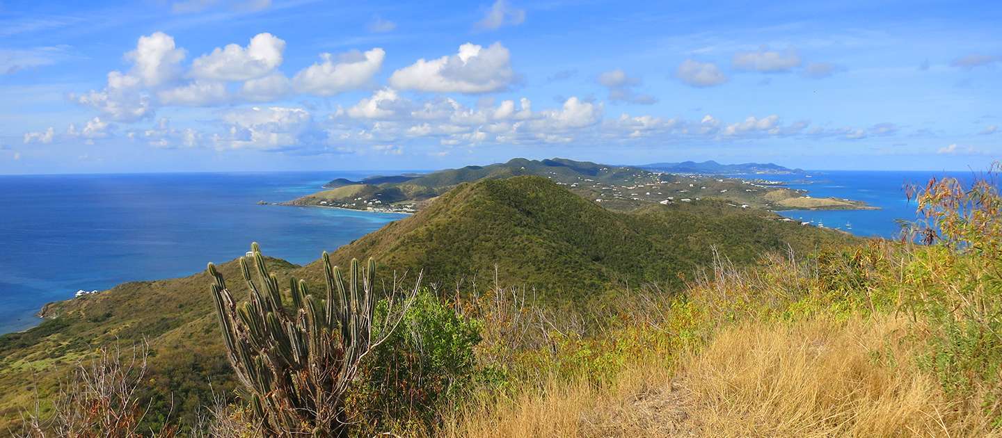
The steep hike up to Goat Hill is worth the effort for the spectacular, unobstructed panoramic views of St. Croix and the Caribbean Sea. You can get to Goat Hill from several different trails, but the easiest starting point is across the street from Cramer Park on the east side of the Baseline Array Telescope. Depending on the time of year, you may find lush green vegetation and flowering Ginger Thomas bushes as you ascend, or it may be mostly brown and dried up vegetation and cactus. Regardless, it’s still worth the hike up for those postcard-worthy views.
DETAILS
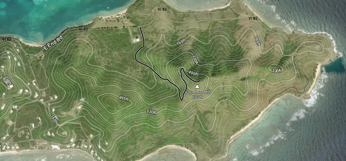
- Distance: 2 miles (roundtrip from Cramer Park).
- Approximate Time: 1.5-2 hours (roundtrip).
- Highest Elevation: 672 feet
- Location: 17.7532°N 64.5781°W
TRAILHEAD
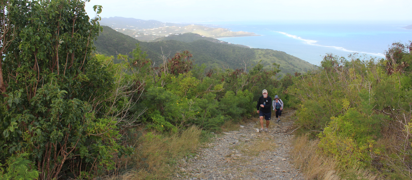
The trailhead starts across the street from Cramer Park on the east side of the Baseline Array Telescope (which looks like a giant satellite dish). After you pass the Baseline Array Telescope on your right, turn right on the dirt road and follow the road up to the top. After about 7/10 of a mile, there is a flat area with a view and a choice of two roads. Take the road to the left, that goes uphill. The trail itself is an old four wheel drive road which is now thoroughly rutted and rocky, so it has become essentially a hiking trail only.
HIKE DESCRIPTION
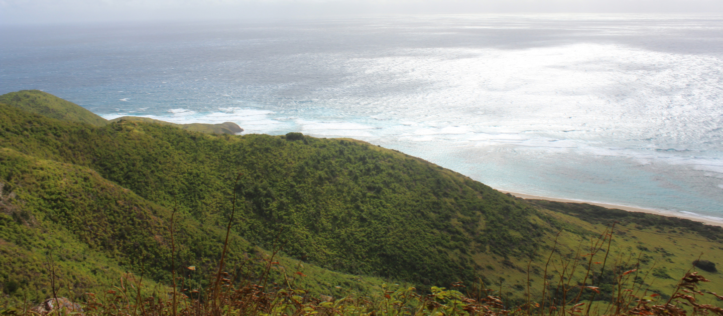
The terrain is rocky and covered with loose gravel and small to medium rocks. As you ascend the slope increases gradually from the bottom through the first overlook, then becomes steeper. As you hike, you’ll find yourself surrounded by native plants such as cactus, casha, ginger thomas and eugenia. Ginger thomas (Tecoma stans) is the official flower of the US Virgin Islands and is covered with beautiful yellow bell-shaped flowers much of the year. You may also see hermit crabs, green anole lizards, and lots of different species of birds. The views from the first overlook are great, and there is usually a nice breeze making it a great place to stop and catch your breath.
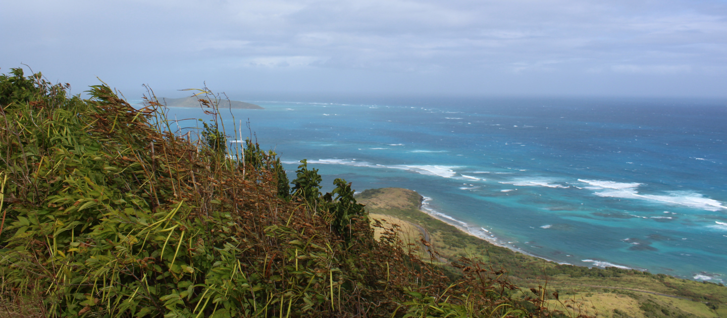
Once you get to the top of Goat Hill, you’ll be able to look west down the ‘spine’ of the island as well as look out over the Caribbean Sea on both sides and Buck Island to the north. Looking east you’ll see Point Udall, as well as Jack and Isaac Bays.
KNOW BEFORE YOU GO
- The area can get very hot, especially in the Summer and Fall months, and there is no shade along the trail. It’s best to start early in the morning and wear lots of sun protection. It also makes a great sunset or night like during a full moon.
- There are no amenities, so bring plenty of water. Since the terrain is rocky, wear sturdy footwear that ties or straps onto your feet.
- For your safety, do not hike alone, and proceed only if you are physically fit enough to complete a hike safely.
- There is little to no cellphone reception at the base of the trail, service in this area is spotty at best.
- Vehicles can be parked at Cramer’s Park, a couple of hundred feet down the road and then hike to the trailhead. Do not leave any valuables in your car while hiking.